Change is a natural part of life. However, what kind of change we want to see in our lives and to leave for our children and grandchildren—good or bad—is still a question that we need to answer. And if we look at what Google Earth is telling us, we have a long way to go to properly make up for what we’ve been doing to our pale blue dot, our home, Planet Earth.
Google Earth posted a series of videos over on YouTube showing how much our world’s oceans, forests, glaciers, beaches, and cities have changed from 1984 to 2020, as a way to promote climate awareness through its new timelapse feature.
Have a look below at how human activity and natural forces have changed the Earth, dear Pandas. You'll find the links to the original videos underneath each photo in this list. And remember, stopping climate change is up to us. Even if things seem grim from the four decades’ worth of video imagery we’ve seen, there’s always hope.
Image credits: Google Earth
#1 Dubai, Uae
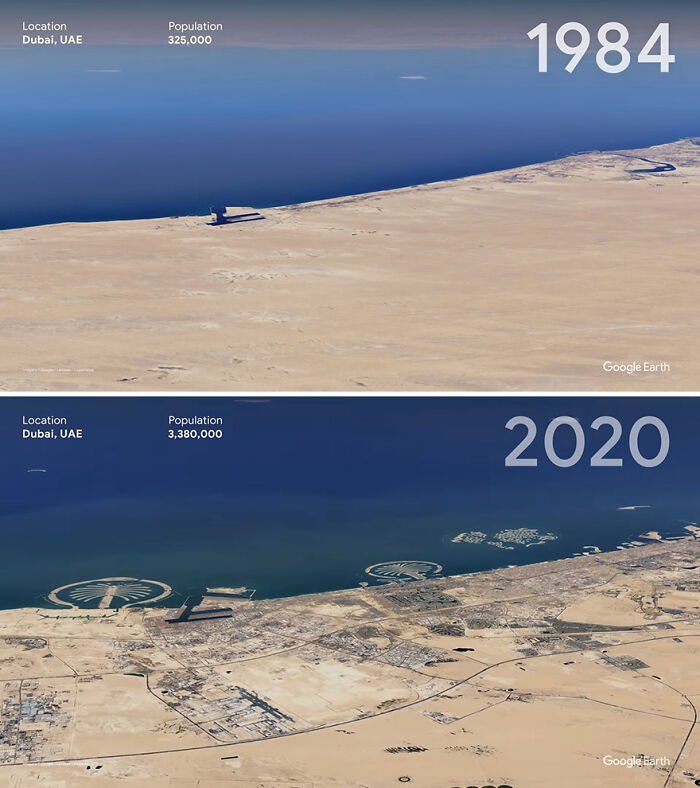
Image credits: Google Earth
#2 Mato Grosso, Brazil
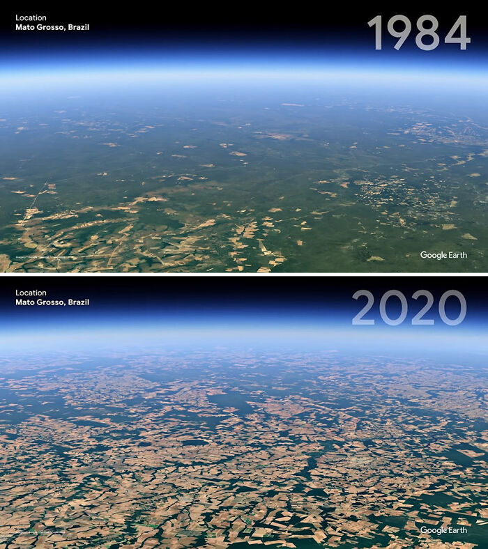
Image credits: Google Earth
#3 Las Vegas, USA
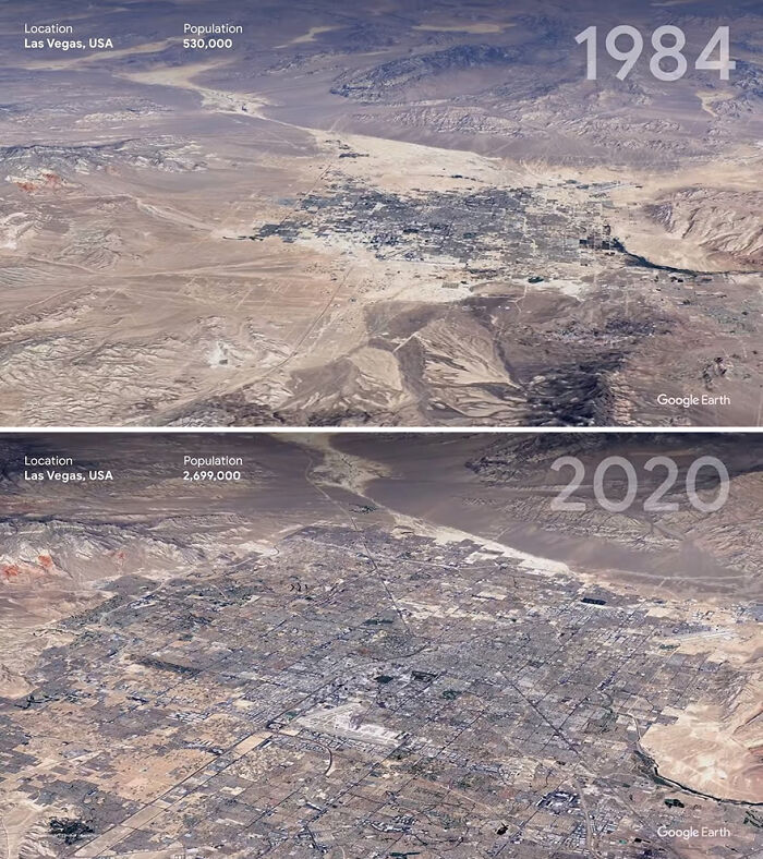
Image credits: Google Earth
It’s not all doom and gloom, however. Even though Google points out that nearly half of the world's forests have already been cleared or degraded for human use, the rate of deforestation has dropped.
Between 2015 and 2020, the rate of deforestation was around 10 million hectares per year, down from 16 million hectares per year in the 1990s. This doesn’t change the fact that trees are being cut down at an alarming rate, however, the rate has dropped significantly. Whether that trend continues depends on us.
#4 Shanghai, China
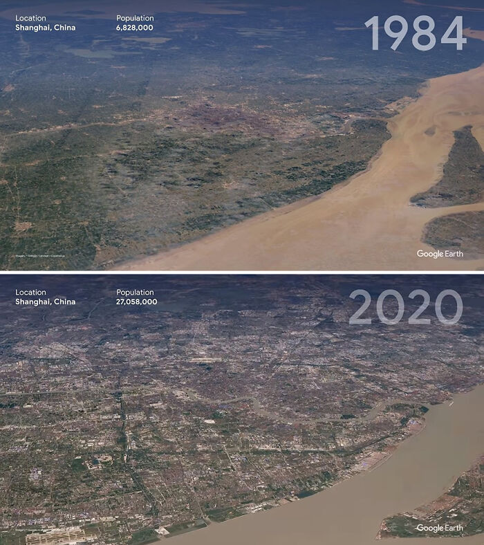
Image credits: Google Earth
#5 Nuflo De Chavez, Bolivia
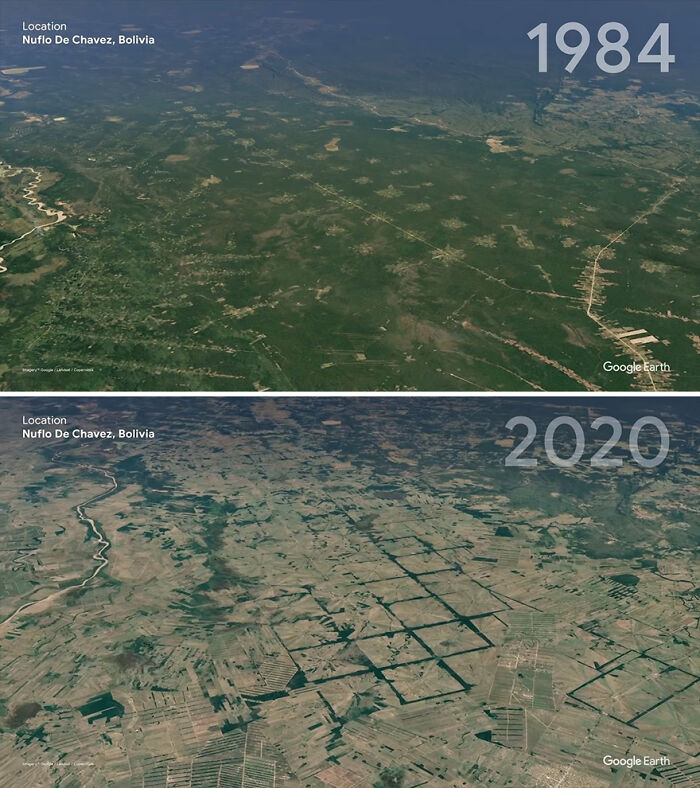
Image credits: Google Earth
#6 Newfoundland And Labrador, Canada
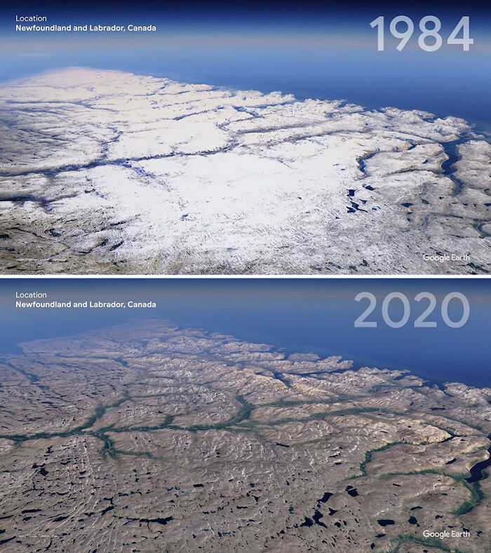
Image credits: Google Earth
The message that Google’s sending to everyone is pretty clear: human beings are having a huge impact on the climate (and the best way to see the evidence for yourself is with its new timelapse tool).
For the timelapse project, Google partnered up with lots of government agencies including NASA, the US Geological Survey, and the European Space Agency (as well as the European Union itself!). According to Forbes, the timelapse feature uses around 24 million satellite photos gathered by Google Earth from these agencies to show how nature has changed over time.
#7 Columbia Glacier, Alaska, USA
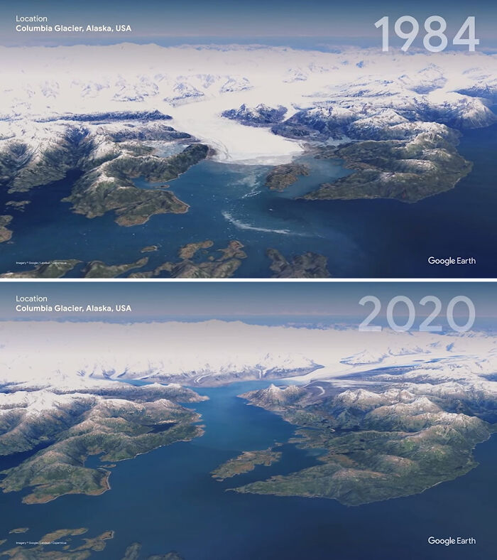
Image credits: Google Earth
#8 Mylius-Erichsen Land, Greenland
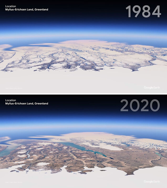
Image credits: Google Earth
#9 Pearl River Delta, China
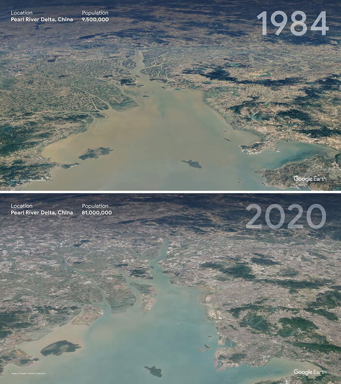
Image credits: Google Earth
Meanwhile, the timelapse tech was created with the help of Carnegie Mellon University. Over 2 million processing hours were needed to process the 20 petabytes of imagery to create the 4.4 terapixel zoomable video mosaic of Planet Earth. Which is a fancy and technical way of saying that a huge amount of effort went into the project. Remember that as you’re using the tool.
Natalie Mahowald, a climate scientist at Cornell University, told The Associated Press that the timelapse project is “amazing” and will help people understand climate change and its effect on our environment in a more tangible way.
#10 Singapore
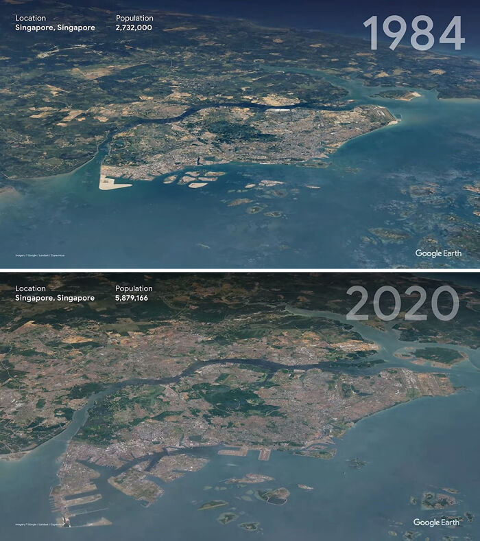
Image credits: Google Earth
#11 Enright, Oregon, USA
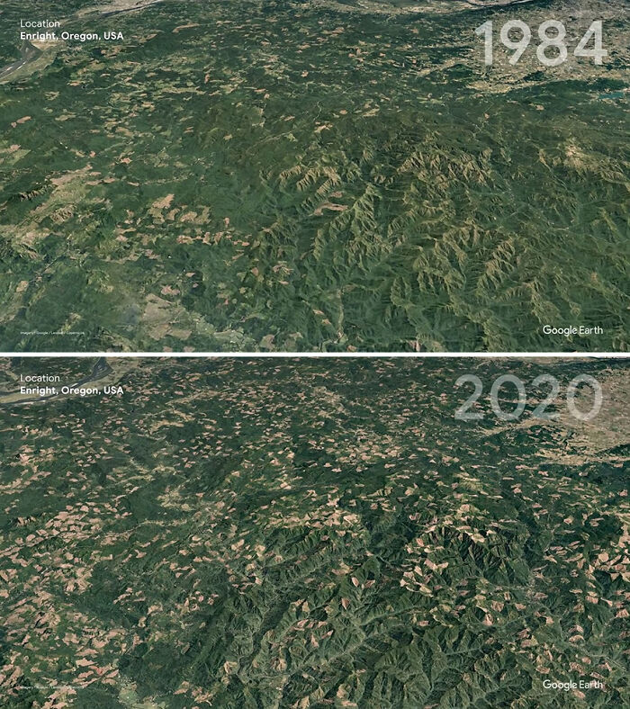
Image credits: Google Earth
#12 Atsimo-Andrefana, Madagascar
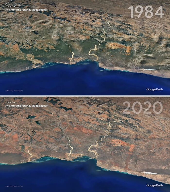
Image credits: Google Earth
“Trying to get people to understand the scope of the climate change and the land-use problem is so difficult because of the long time and spatial scales. I would not be surprised if this one bit of software changes many people’s minds about the scale of the impact of humans on the environment,” Mahowald from Cornell Uni said.
This isn’t the end to Google’s ambitions, however. The company has promised that we’ll all able to see timelapse presentations of pretty much any place that we want.
#13 Sara, Bolivia
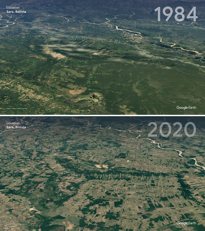
Image credits: Google Earth
#14 Mamore River, Bolivia
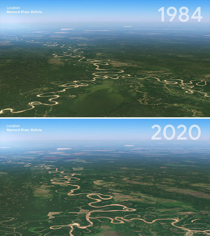
Image credits: Google Earth
#15 Chatham, Massachusetts
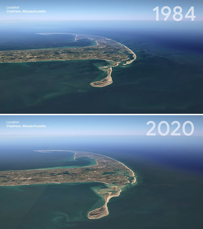
Image credits: Google Earth
Have a look at the tool and the videos, explore things a bit, and report back with your thoughts, dear Readers. Do you think it’ll help raise awareness about climate change? Let us know in the comment section.
#16 Aral Sea, Kazakhstan
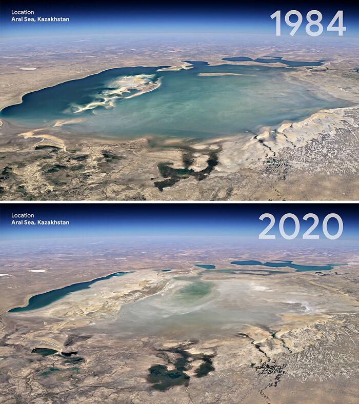
Image credits: Google Earth
from Bored Panda https://bit.ly/3tIHWgJ
via Boredpanda